Homeowners
Free, always.
Check before you sign.
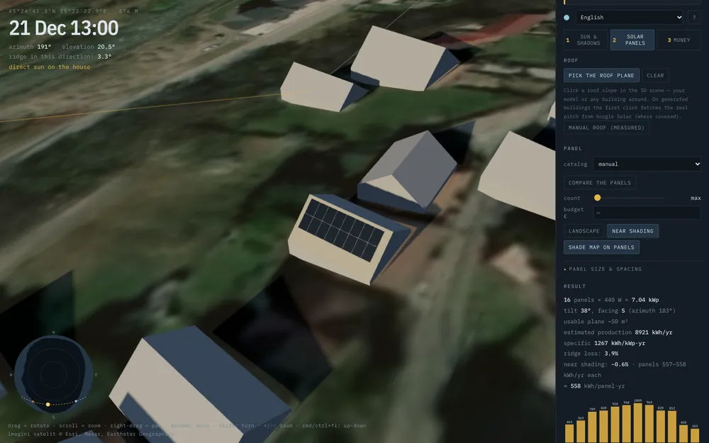
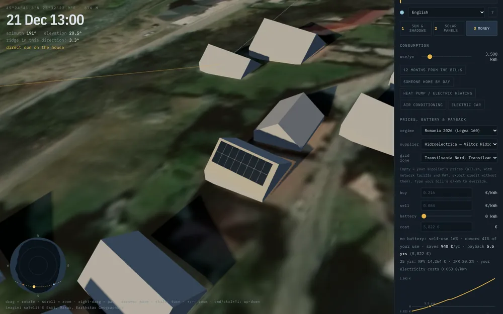
See whether the panels get sun in winter too, how many fit on the roof and how long they take to pay back. With those numbers in hand, you can compare quotes like for like.
Open the simulatorSun · shadows · solar panels
Hikina builds your place in 3D from real terrain, satellite imagery and the buildings around it, then follows the sun on any day of the year. See the shadows, the hours of sun on every window and what panels on your roof will really make, before you spend a cent.
The real horizon
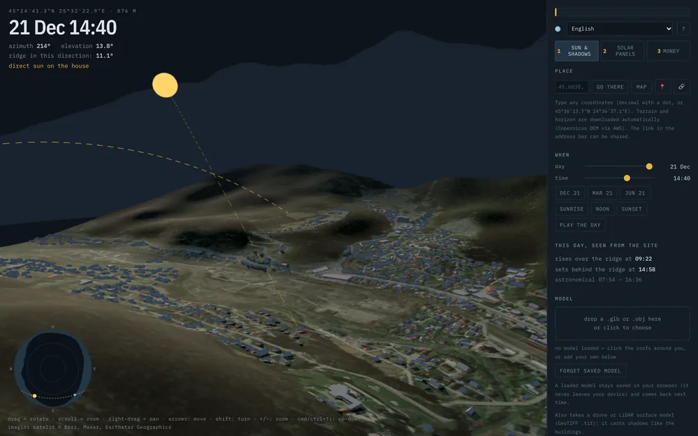
Most solar calculators assume a flat horizon. Solar quotes are often made from a bill and a photo of the roof. Neither one sees the hill behind the house.
Hikina downloads the terrain 25 km around and works out how high the ridge is in every direction. Then it follows the sun minute by minute.
In Bușteni, on 21 December, the sun clears the mountain only at 09:22 and drops behind it at 14:58: 5 h 36 min of sun out of an 8 h 42 min day.
What you can do
Who it's for
Homeowners
Free, always.
See whether the panels get sun in winter too, how many fit on the roof and how long they take to pay back. With those numbers in hand, you can compare quotes like for like.
Open the simulatorSolar installers
Terrain, shading and yield for any address in minutes. A PDF quote with your logo and prices, the simulator on your own website, and leads from the counties you work in.
For installersArchitects
Hours of sun on the neighbours' windows on 21 December, before and after the new building, under Romania's Order MS 119/2014. Hourly shadow plans and the report as PDF. Rules for Moldova, Poland, Czechia, Slovakia, Ukraine and EN 17037 too.
Sun studyHow it works
Coordinates, the map or “my location”. The link in the address bar points exactly there, so you can send it to anyone.
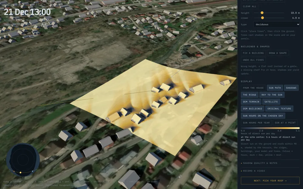
Terrain 25 km around (Copernicus DEM, 30 m), satellite imagery, the surrounding buildings and real weather from the last three years. On request, trees too, estimated from satellite.
Move the day and the hour and watch the shadows. Click a roof and get the panels, the output and the payback.
Questions
Yes, for homeowners, and it stays that way. The money comes from businesses: installers and architects.
Yes. Terrain, satellite imagery and weather cover the whole globe, and the surrounding buildings come from OpenStreetMap. Component prices and prosumer rules are for Romania for now; elsewhere you enter your own prices.
The ridge comes from Copernicus terrain data at 30 m, so the times the sun clears a mountain are reliable. We compared the yield with PVGIS (the European Commission's Joint Research Centre) at 20 sites: in the lowlands it comes out about 3 % higher on average, in the mountains more, because the solar radiation datasets disagree there. Neighbouring building heights are estimated, and you can correct them.
No. The surrounding buildings appear by themselves with gable roofs; for an existing house, click its roof. For a new house, drop the architect's model (.glb or .obj) into the page or draw the volumes.
It means “east” in Hawaiian, the direction the sun rises from. Every sunny day starts there.